Digital Transformation of Geological Mapping and Mining
Geological mapping and modelling which connects geoscience with location-based information, provides valuable insights for sustainable resource development, land use planning, hazard and risk management, etc. Geological survey agencies across the world have traditionally been engaged in basic geological mapping and resource assessment to map out features of the earth’s surface, and offer guidance for natural resource management. As countries adopt sustainable development principles, the integration of resource development and environmental stewardship becomes increasingly important, which in turn leads to an expansion of the geological stakeholder ecosystem. As part of the shifting resource development paradigm, geological survey agencies are expected to play dual roles of exploration enablers and information providers to a wide and diverse set of stakeholders. This necessitates understanding the evolving demands of the diverse stakeholders, and adoption of and integration of geospatial and frontier technology in the workflow, which will in turn lead to the development and proliferation of innovative geological modelling tools and predictive geoscience.
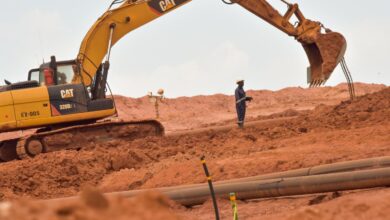
The mining industry has been and will remain a primary stakeholder of the evolving domain of geological mapping. A paradigm shift is happening in the mining industry as well, driven by multiple factors. With newer mineral deposits being increasingly located at greater depths, and in less accessible areas, the industry is re-thinking existing approaches, embracing advances in modelling and analytical tools, and making investments in emerging technology. The transition to a low carbon economy is also further contributing to the paradigm shift, with increased demand for most minerals, due to the mineral-intensive nature of low emission energy and transportation systems. Digital transformation of mining workflow, and systems thinking in mining information management, which will lead to integration of geospatial and frontier technology, and spatial and non-spatial data sources, is crucial for the transition from a geoscience-driven extractive industry to a technology-driven renewable energy sector.
The environmental and sustainability problems being faced by the planet are driving the stakeholders of geological mapping to look beyond resource assessment to new frontiers which necessitate continuous earth systems monitoring and risk assessment. With the increasing urbanization of global populations, and the lack of space in densely populated urban areas, 3D sub-surface mapping and modelling is becoming increasingly crucial for underground space development. Another emerging frontier of geological mapping and research is mapping of ocean floor relief, and sub-bottom geology, which is crucial for marine spatial planning and sustainable use of marine resources. The evolution of geological mapping and mining domains in response to the paradigm shifts of the changing world is raising the need for a digital transformation.
In this context, a one-day symposium on ‘Geology and Mining’, with the theme ‘Digital Transformation Enabling Sustainable Development Mandates’ is being conducted as part of Geospatial World Forum in Rotterdam, The Netherlands. The symposium will take place on 4th May 2023. The abstract submission closes on 10th March 2023.
To learn more about the objectives and points of discussion at the symposium, and to submit your proposal to speak, click here:
https://geospatialworldforum.org/geology-and-mining.php
To participate in the conference and engage in discussions with the geospatial industry experts, register here:
