Earthsense provide MyAir with data upgrade – AirQualityNews

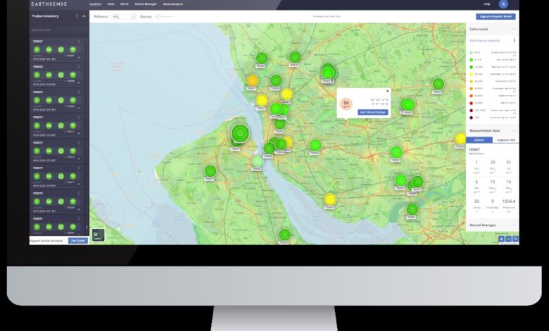
MyAir is a powerful data visualisation and analytics platform from Earthsense, designed to make air quality management effortless.
It offers an intuitive, interactive map for seamless data viewing and advanced analytical tools as well as access to past, present and future air quality insights to help users make informed, actionable decisions to help improve air quality.
The platform is powered by Earthsense’s air quality data model MappAir, including an array of existing air quality data sources such as their own Zephyr network as well as third party sensor data. This provides accurate insights into air quality data such as pollution source identification, meteorological data and hourly forecast data.
Now the team at Earthsense have provided MyAir with a significant update by developing a versatile Data Analytics tab which introduces new features including:
- Easily save and load project views including your Zephyr® networks.
- Interactive graphs with customisable pollutant threshold lines.
- Averaged pollutant statistics and limit value exceedance counts.
- Meteorological data including detailed wind speed and direction plots.
- Zephyr customers will also have access to modelled weather data, including wind and precipitation.
Earthsense are offering potential users a free trial of the system, with no need to sign up for a subscription.
You’ll get access to one of the most powerful air quality platforms on the market, including free access to the MappAir air quality data model, providing you with instant insights into the air quality in your area. Find our form on our website here to sign up for your free trial.
To sign up for the free trial, go here.


